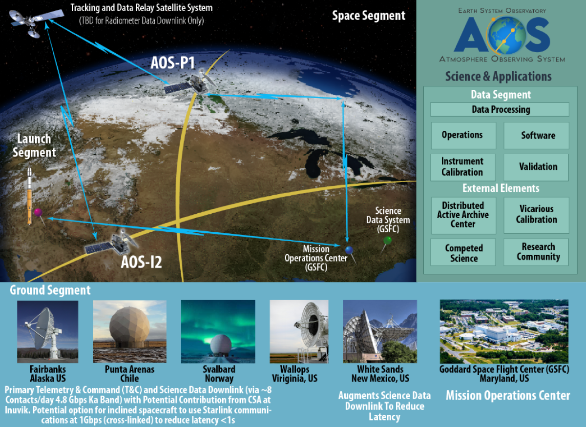
Overview
The Atmosphere Observing System (AOS) will provide measurements that are critical for clarifying aerosol and cloud processes that drive extreme weather and climate change. A dedicated team from several NASA facilities and international partner organizations will develop instruments, build and launch spacecraft, coordinate suborbital instruments and operate the new observing system. AOS is one component of the Earth System Observatory designed by NASA to provide key information to guide efforts related to climate change, natural hazard mitigation, fighting forest fires, and improving real-time agricultural processes. AOS plans are under consideration by NASA and the international partner governments.
Mission Timeline
A high-level overview of the AOS mission timeline is presented here. The AOS mission was preceded by the Aerosols, Cloud, Convection and Precipitation (ACCP) Study. The nominal phases shown apply to AOS satellites in an inclined orbit (AOS-Storm). The timing of mission phases associated with the polar AOS satellite (AOS-Sky) are noted in italics.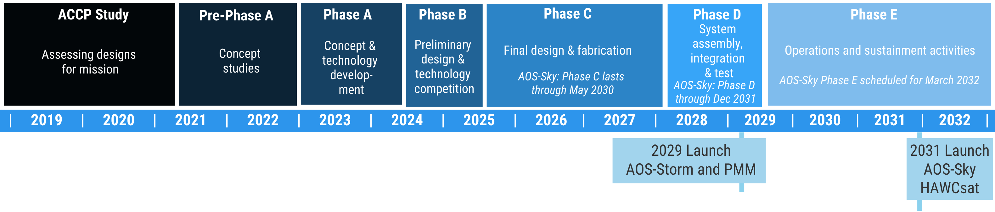
Instruments
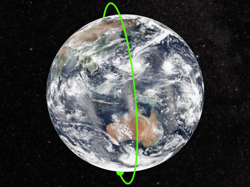
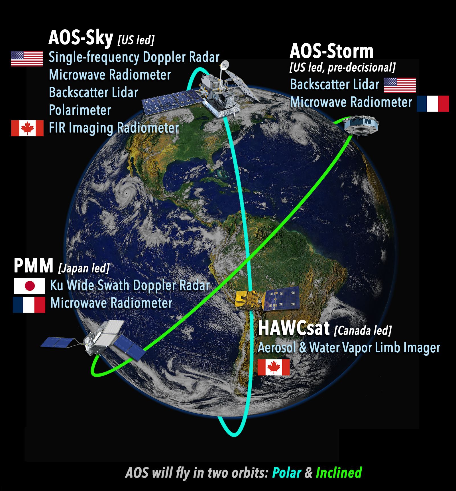
AOS will collect measurements of aerosols, clouds, convection and precipitation using a variety of instruments in various locations from Earth orbiting satellites and suborbital platforms. Four satellites will work together to provide these data. Two satellites traveling in a polar orbit (AOS-Sky and HAWCsat) - passing over both poles with each satellite pass - and two satellites traveling in a 55° inclined orbit (AOS-Storm and PMM). A mix of both the active and passive sensing, from the microwave to the ultra-violet, providing a comprehensive view of how these systems work and interact with each other. The spacecraft will carry a core set of instrument types:| AOS-Sky | |
|---|---|
| Single-frequency Doppler Radar - Single-frequency Doppler radar measures clouds and light precipitation, as well as the associated liquid or ice particle motions along the radar line of sight. | |
| Microwave Radiometer – includes a range of channels to measure ice water path, precipitation, atmospheric temperature and humidity. | |
| Backscatter Lidar - measures attenuated aerosol and cloud backscatter. Backscatter capability at 1064 nm and 532 nm. | |
| Polarimeter – measures polarized radiation at multiple angles to infer cloud and aerosol properties. | |
| Far-Infrared (FIR) Imaging Radiometer - measures ice particle size, cloud top height, cloud longwave emission, water vapor profiles. | |
| AOS-Storm (pre-decisional) | |
|---|---|
| Backscatter Lidar - measures attenuated aerosol and cloud backscatter. Backscatter capability at 1064 nm and 532 nm. | |
| Microwave Radiometer – includes a range of channels to measure ice water path, precipitation, atmospheric humidity. | |
| PMM (Precipitation Measuring Mission) | |
|---|---|
| Ku Wide-Swath Radar with Doppler – Ku band (13.6 GHz) radar measures precipitation over a 255-km wide swath and the associated liquid or ice particle Doppler motions along the radar line of sight at nadir. | |
| Microwave Radiometer – includes a range of channels to measure ice water path, precipitation, atmospheric humidity. | |
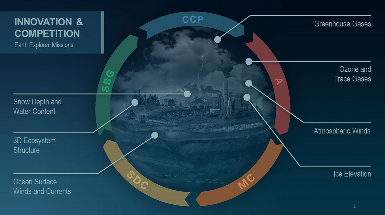
NASA Earth System Observatory
Areas of focus for core of the Earth System Observatory include:
Aerosols: Answering the critical question of how aerosols affect the global energy balance, a key source of uncertainty in predicting climate change.
Clouds, Convection, and Precipitation: Tackling the largest sources of uncertainty in future projections of climate change, as well as improved understanding and prediction of convective storms and severe weather.
Mass Change: Providing drought assessment and forecasting, associated planning for water use for agriculture, as well as supporting natural hazard response.
Surface Biology and Geology: Understanding climate changes that impact food and agriculture, habitation, and natural resources, by answering open questions about the fluxes of carbon, water, nutrients, and energy within and between ecosystems and the atmosphere, the ocean, and the Earth.
Surface Deformation and Change: Quantifying models of sea-level and landscape change driven by climate change, hazard forecasts, and disaster impact assessments, including dynamics of earthquakes, volcanoes, landslides, glaciers, groundwater, and Earth's interior.
Once the core missions of the Earth System Observatory (AOS, Mass Change, Surface Biology and Geology and Surface Deformation and Change) are established, NASA will augment the core with a new class of mission, the Earth Explorers, to make additional high-priority observations and encourage innovative solutions through competitive selection at the mission level.