Suborbital Program


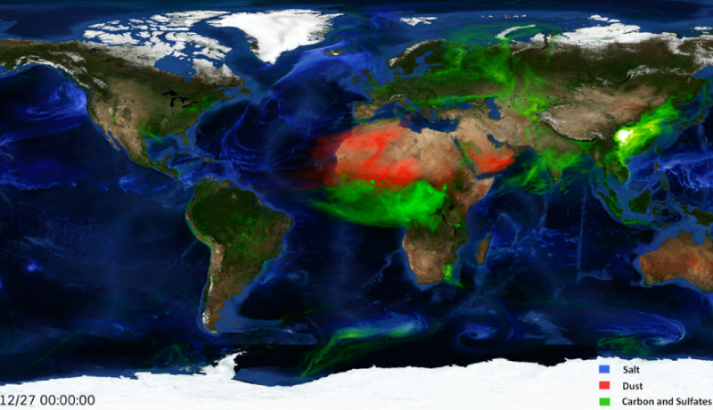
The AOS suborbital program will collect measurements that are needed to address AOS science objectives which cannot be adequately measured from space. This especially involves the need to understand how measurements change over time, and collecting measurements from satellite "blind zones." With the satellites in low-Earth orbit, they will see snapshots of a scene. AOS suborbital measurements can provide context of how a scene changes over time – how a storm grows, or how an aerosol plume spreads.
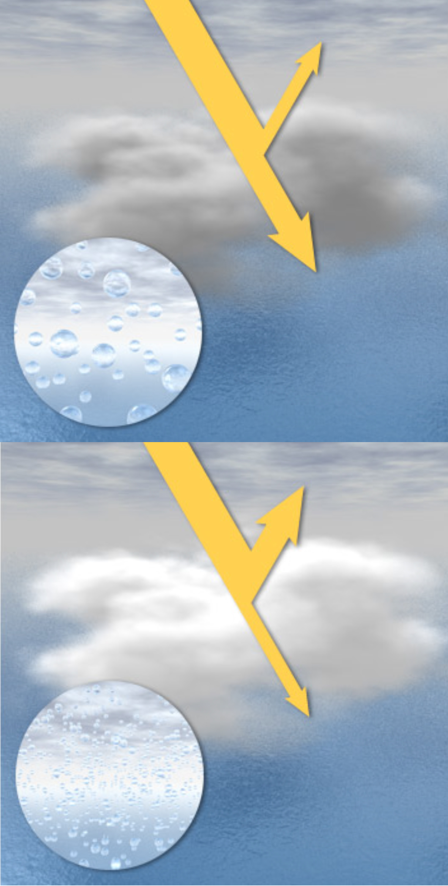
What's a blind zone?
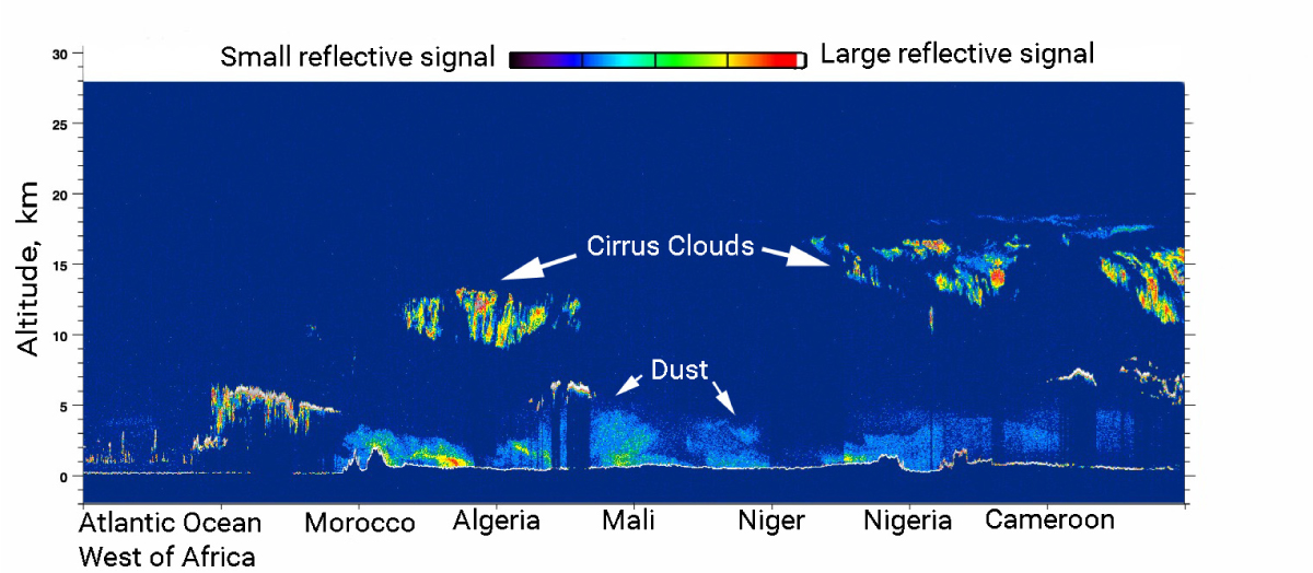
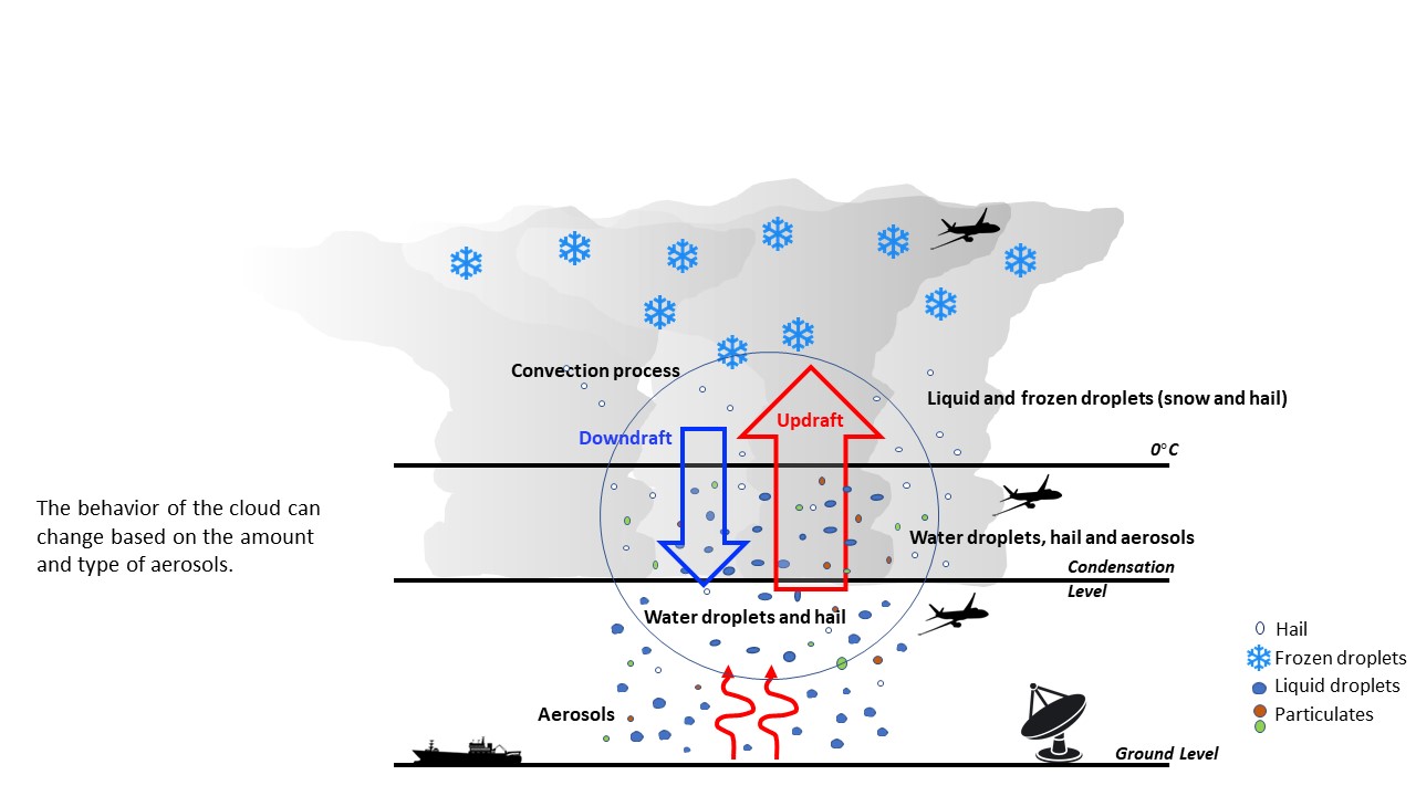
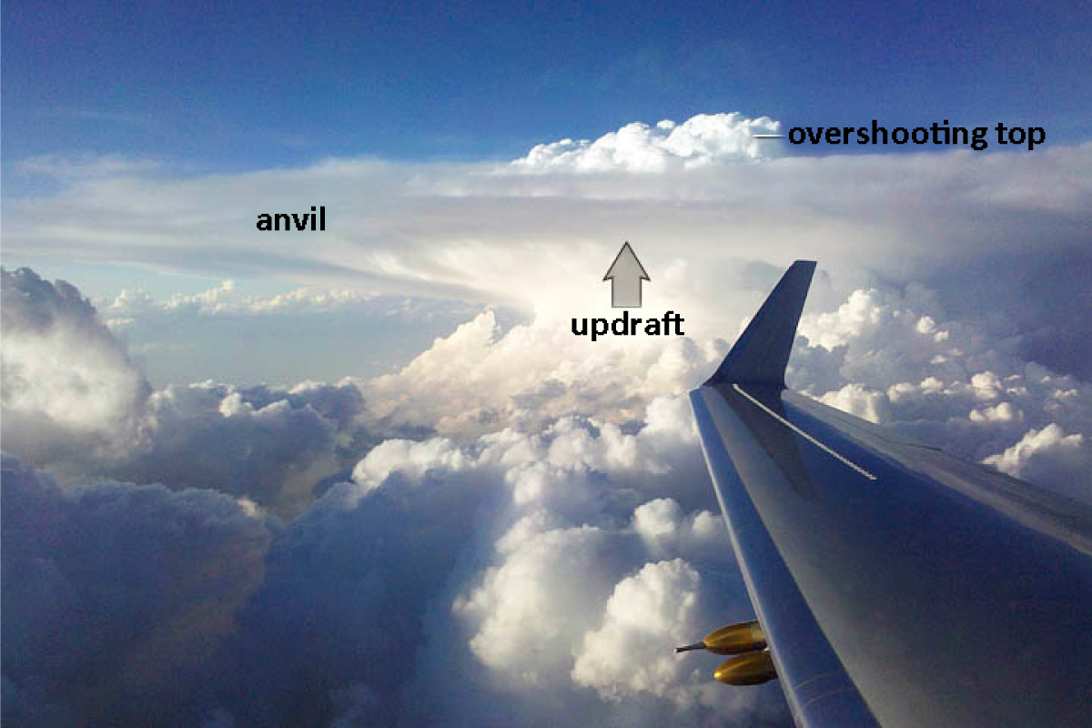
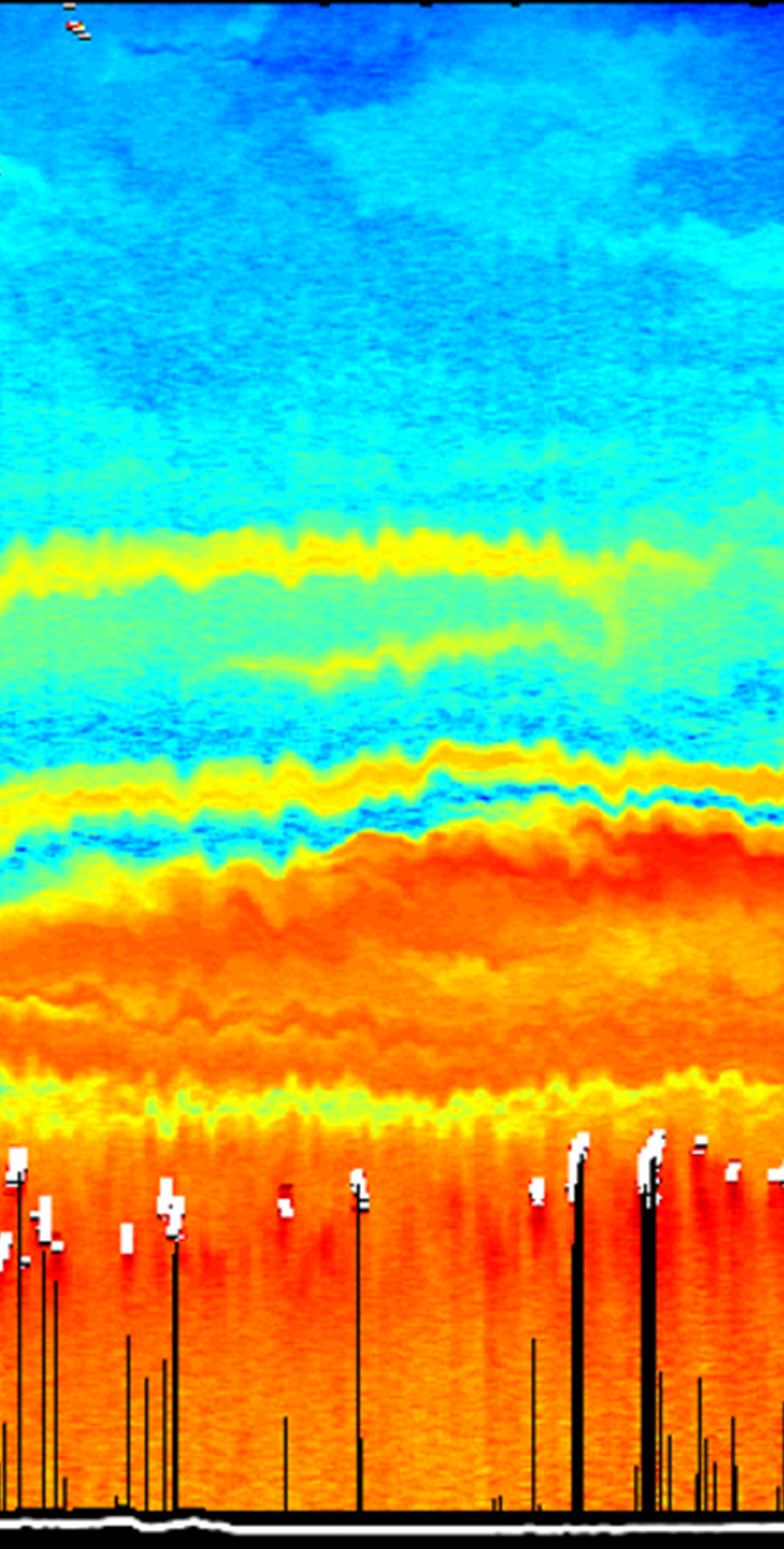
An example of a satellite blind zone would be beneath a cloud layer that blocks the view of some satellite-borne instruments and is too thick for a satellite-borne lidar to penetrate. Or at low altitudes in a strong thunderstorm, with the downward-looking radar signal obscured by the hailstones above. A satellite-blind zone could also be the interface between a cloud and its environment, where sharp gradients are usually smeared out by satellite measurements taken from hundreds of miles away.


What are the key things AOS can't do without suborbital support?
"I'd say investigating temporal evolution of processes, and measurements from satellite blind zones, are both really keys." – Dan Cecil, AOS Deputy Project Scientist, Suborbital
SURFACE-BASED SITES AOS will use surface-based measurements from some heavily-instrumented sites and from networks. AOS will leverage sites already operated by partners and augment them as needed by deploying extra instrumentation that can fill any gaps.
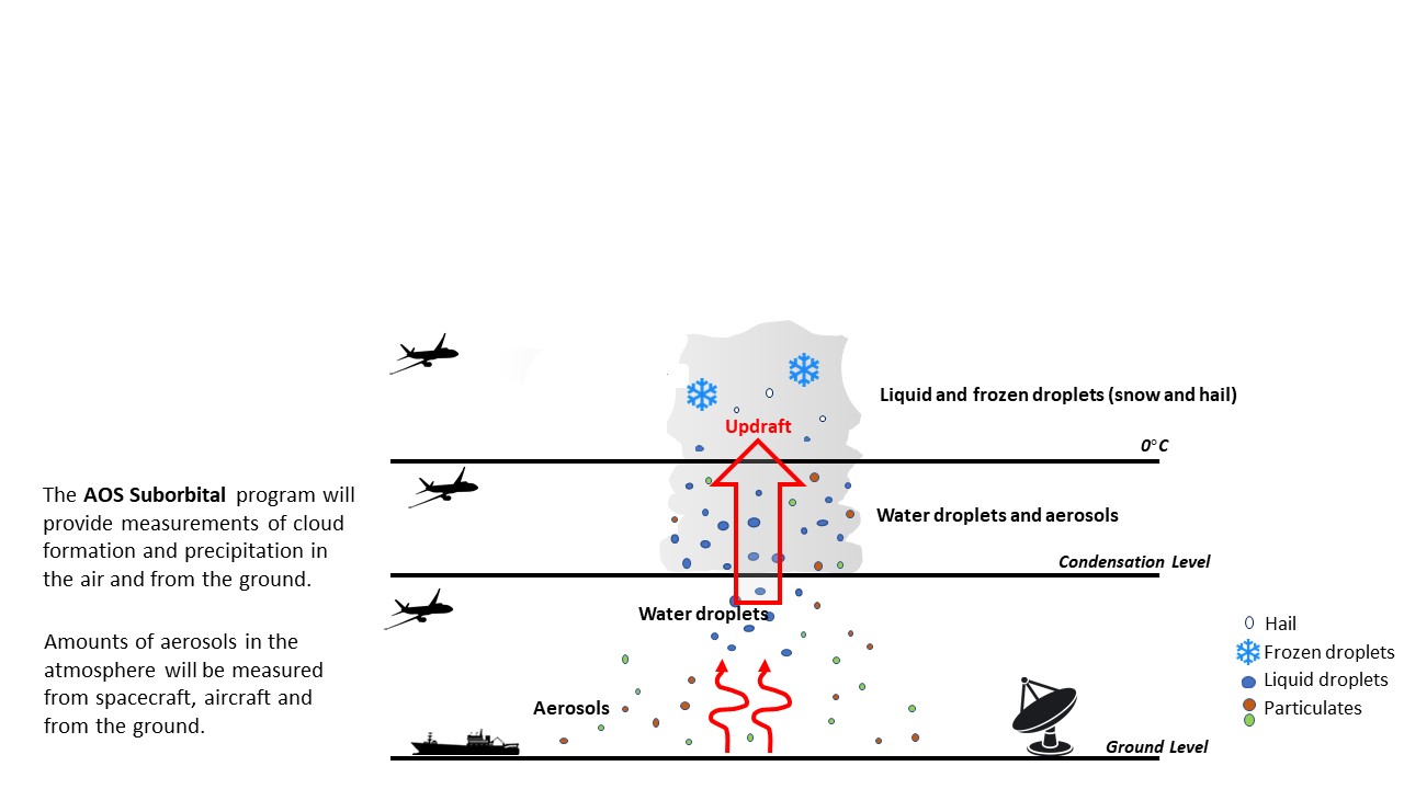
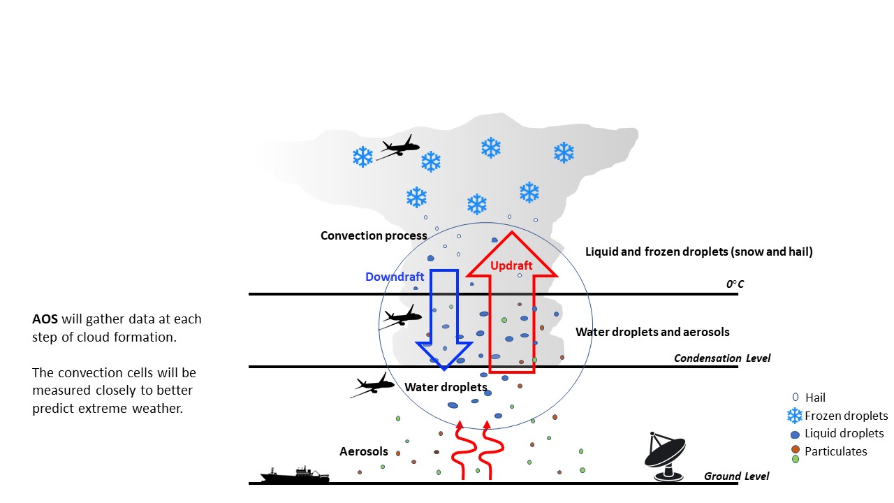
AIRBORNE CAMPAIGNS The AOS suborbital program will include some multi-aircraft field campaigns. These aircraft will have combinations of remote sensing instruments that somewhat mimic the satellite measurements. However, the aircraft will provide finer detail since they will be "up close and personal" to Earth's surface. For example, some aircraft will make direct measurements of the cloud and aerosol properties like those AOS will try to retrieve from satellites. Moreover, some aircraft instruments will have capabilities that are missing from the satellites.
AOS airborne campaigns will target locations to take advantage of some good measurement sites on the ground, and to measure a variety of environments and processes that are relevant to the mission. In addition, partnership opportunities can add measurements in a mutually beneficial way to programs that are led by other missions or agencies.
Roll over the cards below to see the types of science questions that AOS's suborbital program will address.

Key Questions to be Addressed


Key Questions to be Addressed


Key Questions to be Addressed


Key Questions to be Addressed